Hurricane Hunter Meets Milton
How cool is this video of the National Oceanic and Atmospheric Administration’s “Hurricane Hunter”?
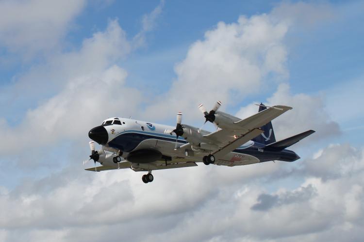
Bumpy ride into Hurricane #Milton on @NOAA WP-3D Orion #NOAA43 "Miss Piggy" to collect data to help improve the forecast and support hurricane research.
— NOAA Aircraft Operations Center (@NOAA_HurrHunter) October 8, 2024
Visit https://t.co/3phpgKNx0q for the latest forecasts and advisories
Visit https://t.co/UoRa967zK0 for information that you… pic.twitter.com/ezmXu2Zqta
I didn’t even know this thing existed, so of course I had to look it up. It’s a Lockheed WP-3D Orion. She’s called Miss Piggy. (There's another plane called Kermit. Too perfect.)
Love everything about them. Read more about them here:
They’re flying into Hurricane Milton, which is shaping up to be one of the worst storms Florida has seen in a quite a while.
The lede from the Atlantic story tells you all you need to know:
As Hurricane Milton exploded from a Category 1 storm into a Category 5 storm over the course of 12 hours yesterday, climate scientists and meteorologists were stunned. NBC6’s John Morales, a veteran TV meteorologist in South Florida, choked up on air while describing how quickly and dramatically the storm had intensified. To most people, a drop in pressure of 50 millibars means nothing; a weatherman understands, as Morales said mid-broadcast, that “this is just horrific.”
Comments